General
Long Mountain is a high ridge running along the east side of Trout Run Valley. There are tremendous views to the west looking over Big Schloss and the Shenandoah valley. Views to the east look out over the rolling ridges of West Virginia.
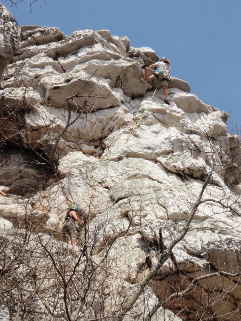
Since the area doesn’t get a lot of traffic expect full on adventure climbing. This isn’t gym climbing so climb with extreme caution. Belay out of fall lines. Watch for loose rock and boulders.
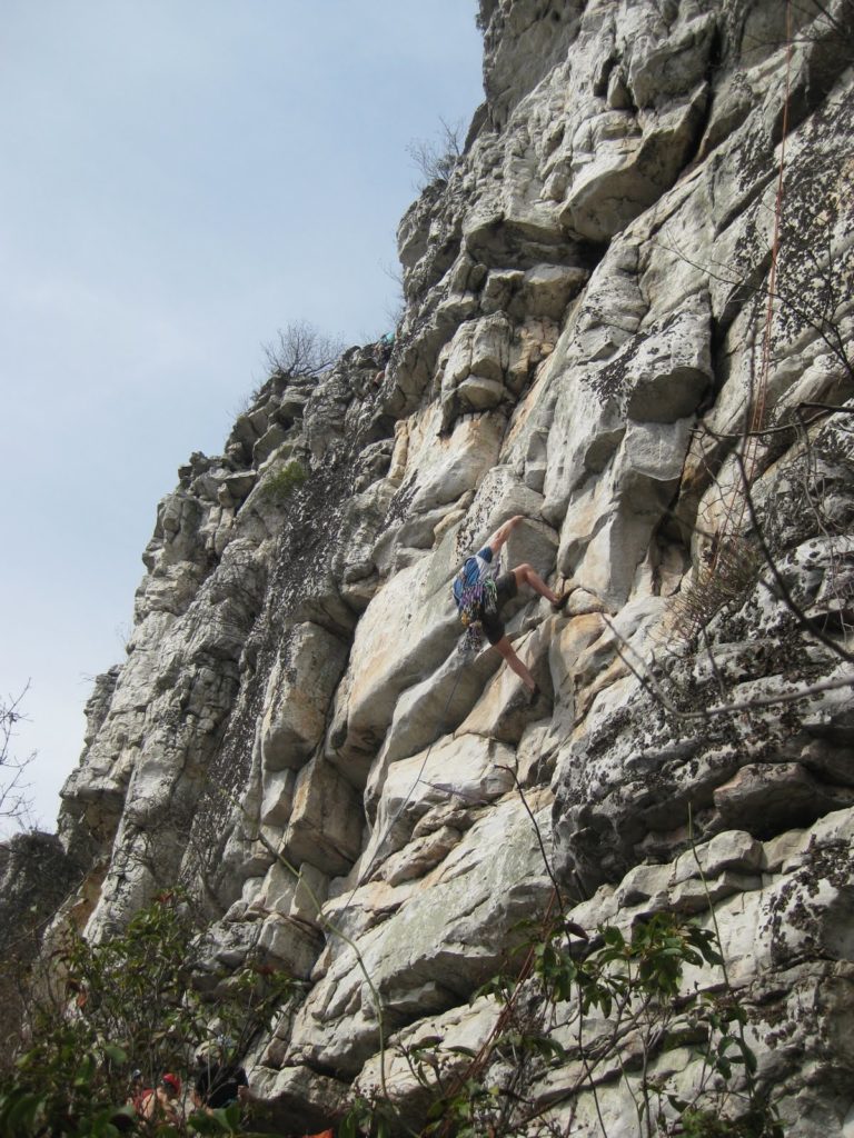
The rock is Tuscarora Sandstone, the same as Seneca Rocks. The cliff faces south east so is hot in summer but ok in the colder months
The majority of the routes here were developed by PMC members Mike Dannhardt and Pat Henner, A few additional routes were added by their friends.
Type of Climbing
Most of the climbing is trad climbing although there are a few bolts. Top ropes can be set with caution because the top of the cliffs are lacking in decent size trees. There are some huge boulders that can be slung. Use caution. Climbs are 45 to 80ft in height.
To lead you need a standard climbing rack and 50/60m rope. Given the presence of loose rock you may want to consider using double ropes.
There is excellent mobile phone coverage for the cliffs and along the approach ridge.
Guidebooks
The Long Mountain Guide is here, and was edited by Mike Dannhardt. Mike has asked for feedback on accuracy, grades etc and details of any new routes You can reach Mike at [email protected].
There is similar information on Mountainproject.
How to Get There
Long Mountain is here in the George Washington Memorial Forest.
Driving to the trailhead
Mile 0: Off I-81 take the Woodstock Exit #283 onto Route 42 South towards Columbia Furnace. This is a right turn at the exit ramp‟s traffic light.
Mile 5.2: Right onto route 768, Union Church Rd.
Mile 5.5: Right onto route 675, Wolf Gap Rd.
Mile 8.4: Right onto route 675, Wolf Gap Rd.
Mile 10.0: Left onto route 789, Sam Clark Rd.
Mile 10.3: Bear right at fork on to route 691, Judge Rye Rd.
Mile 14.3: Park at trailhead for Long Mountain Trail (2900 feet). There is parking and a primitive campsite on the right side of the road. The sign for the Long Mountain trailhead is not visible from the road but yellow “i” shaped blazes can be seen. .
From the trail head, it is an hour’s walk’s along the Long Mountain ridge. Details are given in the guide.
Other Information
In memory of Adam Kopley, who fell while attempting to put up a new route here, please climb with extreme caution. The following routes were named by Mark Fletcher in Adam’s honor: Adam Kopley Memorial Route at Buzzard Rocks and Kopley’s Corner at Little Stony Man in the Shenandoah National Park.
For weather forecasts, Long Mountain is near Woodstock VA and Wardensville WV.
Camping is possible at the Wolfgap primitive campground, at the Long Mountain trail-head, and on the ridge immediately east of the cliffs. You need to bring water for both
At the Woodstock exit off I-81 there are various fast food joints and restaurants on both sides of the highway. There is a super Wal-Mart at the I-81 exit for basic stuff.